



Discover the World with Google Earth Flight Mode
Automatically translated
 Writer
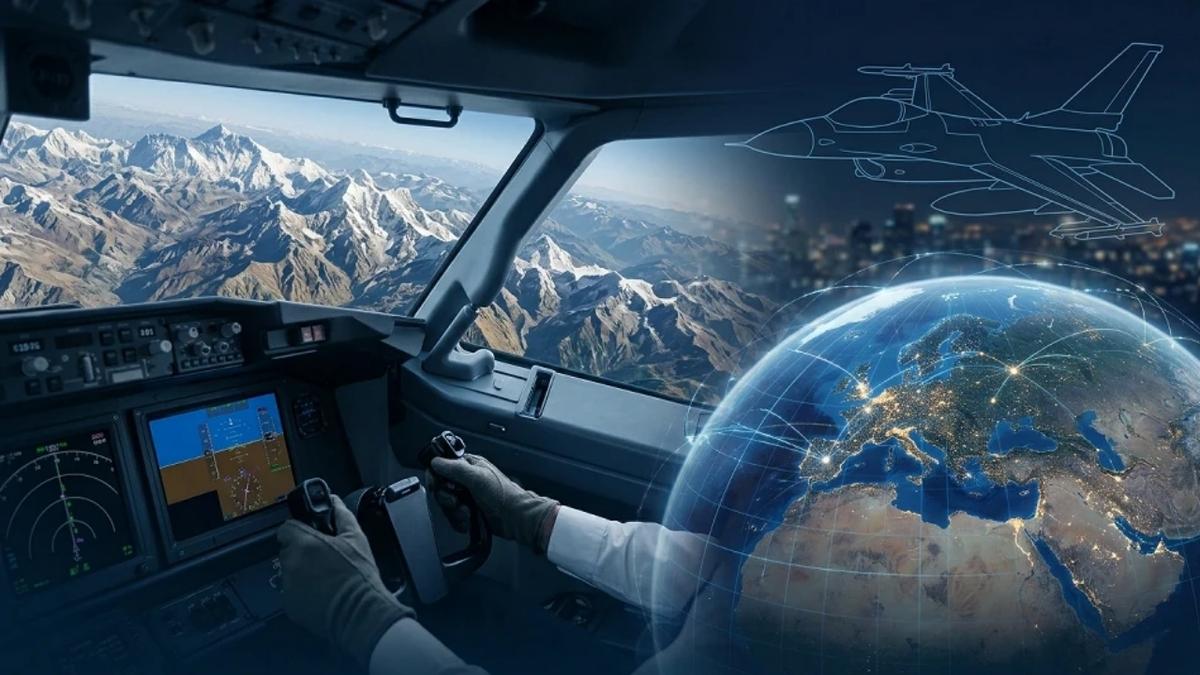
The desire to become a pilot that most of us decorate childhood dreams is gaining a new dimension in the digital world with the possibilities of modern technology. Google Earth, one of the favorite platforms of digital mapping, geographic exploration and simulation enthusiasts, continues to force the limits that cater to this global passion. Thanks to the new infrastructure developed, the popular flight simulator feature, which allows users to fly freely as they were in a jet cockpit on the world, moved to browsers with a great modernization process. It is now possible to download any additional software, without having to deal with installation files, to become a partner of this fascinating experience directly through the Google Earth web version, and discover this new freedom that cloud technologies offer in the browser tab completely free.
Developed this new Google Earth flight modeThe browser-based map experience is completely out of being a passive observation tool or a static address search engine. The platform converts the user to an interactive gaming, education and global exploration platform that takes the user to the center of the process with its free mobility it offers.
A Perfect Virtual Discovery on Web Browser
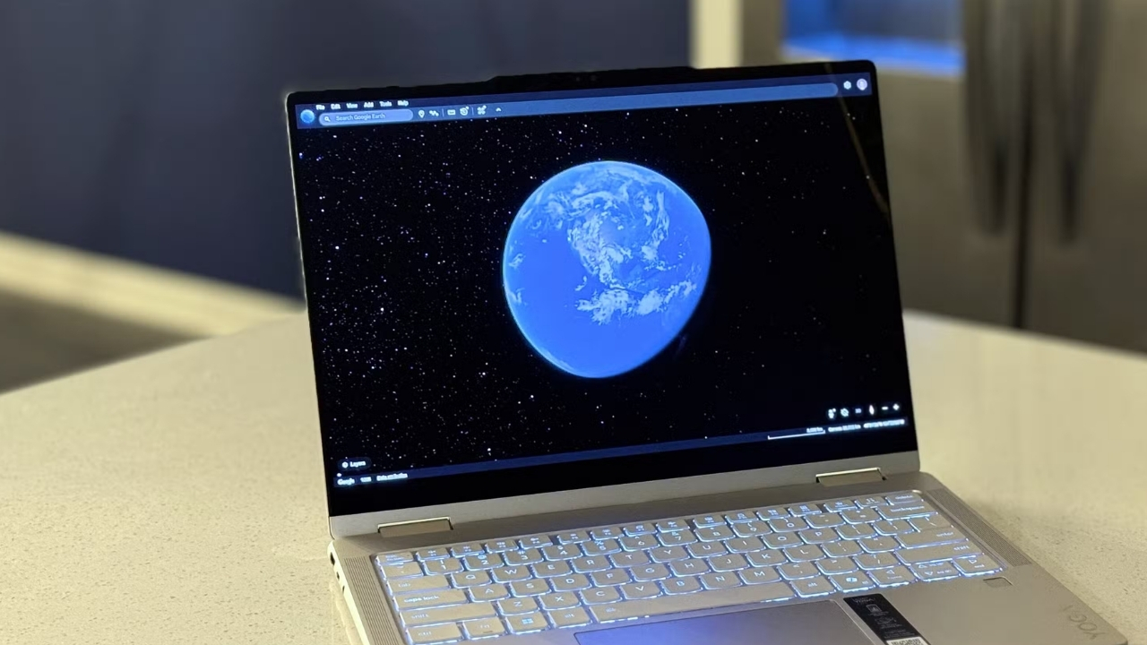
In past years, users who want to live this simulator experience one-to-one need to download special external software, optimize system settings and solve rather complex keyboard combinations. Google has completely democraticed this experience by taking the latest power back of web technologies, especially WebGL and advanced browser engines and was accessible for everyone. Users can now open their favorite web browsers and find themselves in just a few clicks from the architecture labyrinths of New York skyscrapers, or while amazed at the peak of Himalayas. Creating revolutions in the sector advantageous converter power of cloud computing technology Thanks to internet browsers now prove not only simple tools that upload text and visuals, but once again become an independent operating system that can run even massive gaming engines.
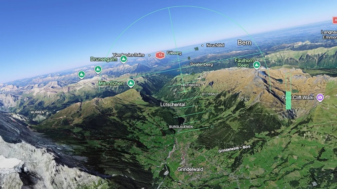
This inclusive virtual discovery experience does not only offer an ordinary and two-dimensional bird view. The architectural texture of cities creates a real feeling of flight to the pieces coupled with advanced 3D map technology, which includes the folds of mountains, river beds and all geographical depths of valleys. The basic cockpit mechanics of iconic aircraft models such as F-16 Fighting Falcon or Cirrus SR22, physics engines and wind resistance, details are best optimized to the browser window.
What Are the Featured Features of Flight Simulator?
This dynamic mode, which moved to the web version of the platform, has been equipped with advanced technical details that compete with the mechanicals of professional gaming studios, which contains much more than an ordinary map navigation. The key features that stand out in this new generation simulation experience based on the browser are as follows:
Different Experiences with Double Aircraft Option:
Two different flight characters are offered in simulation for aerospace enthusiasts. The F-16 Fighting Falcon model is ready for quick, aggressive maneuvers, to force the limits of sound speed and want to experience the tremendous acceleration of the jet engine. The Cirrus SR22 model is an ideal alternative for those who want to examine the shape of the earth, architectural structures and natural beauties with a detail-oriented geographical discovery. Instant transitions between planes, in- cockpit physics rules and flight dynamics are also completely replaced by two different gaming areas to users.
Advanced Control and Hardware Support:
Flights in the sky are not limited only with keyboard and mouse combinations. Thanks to the development of browser APIs, external joysticks that can be easily integrated into the system, game handles and flight pedals, a truly professional simulation venue is achieved.
Realistic Atmosphere Modeling and Instant Fluidity:
The power of the webGL-based advanced rendering engine takes visual realistic to the top level. Layered cloud designs in the sky are constantly calculated on the background and reflected on the screen, with instant changing dynamic night cycle cycles, light fractures and mountains that are shaped according to the developing angle of the sun rays. Digital world Home AI risks and reality review Given the limits of perceived management and visual accuracy that are often discussed in the processes, the instant visual data flow of this system is combined with high-resolution textures from satellites and the perception of spatial reality in high altitude and fluidity maximizes its feeling.
Technical Limitations of Google Earth Flight Simulator
Although this browser-based freedom offered by the platform creates a tremendous discovery space for the general user audience, there are certain technical limitations of flight simulation. Some points on behalf of experienced users and aerospace enthusiasts, especially accustomed to professional aviation simulations, can stay under expectations:
Access Only on Web Interface:
This newly developed flight simulator mode works with an integrated architecture that fully integrates Google Earth’s web version. The absence of this advanced modern infrastructure in the desktop or mobile applications of the system, users are completely dependent on browser windows.
Simplified Aerodynamic and Flight Physics:
This feature is optimized for a geographic discovery experience that the overall user audience can move comfortably, rather than a professional piloting training with high accuracy rates. Thus, advanced physics motor dynamics such as realistic wind fractures, detailed engine failure simulations or precision aerodynamic friction forces are not included in this infrastructure.
Instant Data Processing and Dynamic Loading Complications:
While moving at high speeds on the sky, three-dimensional buildings on the earth, topographic details and high-resolution textures are taken dynamically from cloud servers. Especially when aggressive flights are made with models that can reach high speed, such as jet motor F-16, or on internet connections with low bandwidth, instant loading delays and visual sweeps can be experienced without data flow rate.
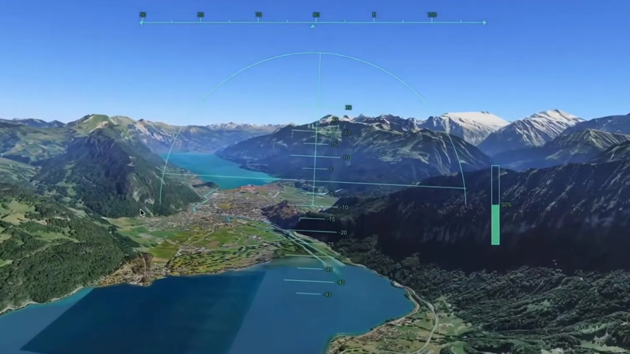
Technical Details and Ease of Use
This big step that Google jumps on the map service is a technical show attribute, especially cloud-based tools, server-sided data processing, and how much browser performance evolve on the global scale. This flight mode accessed via the browser is not inserted into hardware restrictions thanks to its powerful optimization despite the huge algorithms working in the background a fluent simulation experience on global scale Home lets you live. Devasa geographic data is instantly withdrawn from cloud servers as they run in the sky and parts are loaded without tinglinguating the screen card.
From the old, we needed serious screen cards, high RAM capacities and strong processors to run the simulations with this high graphic quality and intensive data flow without error. Thanks to the new infrastructure of Google Earth, this luxury eliminates and this innovative feature can work in the most basic computers and light browsers without frosting, jewelry or warming problems.
Moreover, this situation, which is offered for users completely free, hardware independent digital transformation and new generation technology trends Home It offers a very important breakpoint in the industry. This innovative step of the platform gives powerful tips to what the artificial intelligence-supported visual processing processes will move map services and geographic information systems in the future. In this context, cloud solutions that make user experience completely independent from local hardware; digital publishing, software world and content consumption are considered as a new global standard.
How to Start Flight on the Browser?
To rise directly to the sky without losing time with any installation or add-on installation tab A few simple steps in the modern interface of the platform It is enough to follow: Access to Google Earth Web interface via a compatible and up-to-date web browser (Chrome, Edge, Firefox etc.). The vehicles in the left or right menu are activated in seconds with the help of the on/roads tab or the platform offers. After the aircraft model (F-16 or SR22) is selected, one of the famous airports in the world as the starting point can be determined as the runway or can be ventilated directly to the sky from any coordinates wondered on the map.
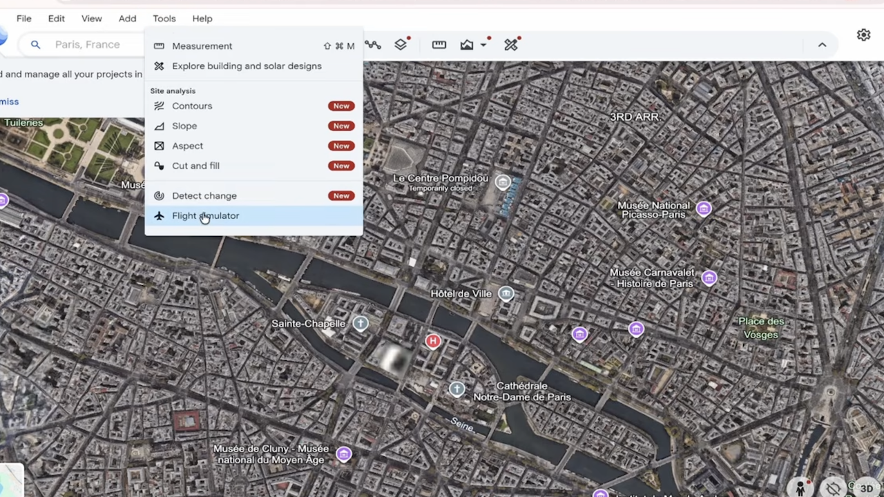
Keyboard Shortcuts and Tips for Beginners
When it does not have an external gaming arm or a professional joystick hardware, the advanced keyboard mapping infrastructure that web-based simulation offers is activated. This flexible structure, which enables users who are foreign to the aerospace physics to adapt to the sky in a short time, brings basic physics motor dynamics to the tip of the fingers. Thanks to the basic, practical and critical commands on the keyboard, the departure with the most demanding stages of the flight can be managed by a completely objective control mechanism:
Acceleration / Gas Enhancing:
The "Page Up" button on the keyboard gradually increases the engine power and speed of the aircraft, "Page Down" button allows slowing and cutting speed for landing.
Direction and Wing Controls:
Standard direction arrows (Finger, Down, Right, Left) help to remove the nose of the aircraft into the air, download down and make sharp turns to the right-sola by changing the wings angles.
Altitude Fixing:
By holding the "Login/Enter" key short-term, the current altitude of the aircraft can be fixed (height) so it can be easily avoided from sudden turbulence effects or harsh gravel.
A New Game Area For Geography Curiosies
The ultra-high-resolution textures that are instantly installed on the background during the flight, real-time geographic data from satellites and perfect ballographic accuracy, technology enthusiasts are ruined by a global visual feast that will take hours. The world’s most iconic cities, thousands of years of ancient cities and reachable power can be filtered using free camera angles on three-dimensional digital twins of nature wonders, not only offers a fun-purpose simulation experience. This advanced infrastructure; digital content producers, architects, city planers and geography researchers also create a new, living and continuously updated visual data pool. In today’s world where physical travel is cost-effective and difficult to cross boundaries, technologies that remove such limits are fully integrated into the digital environment of global tourism and exploration culture.
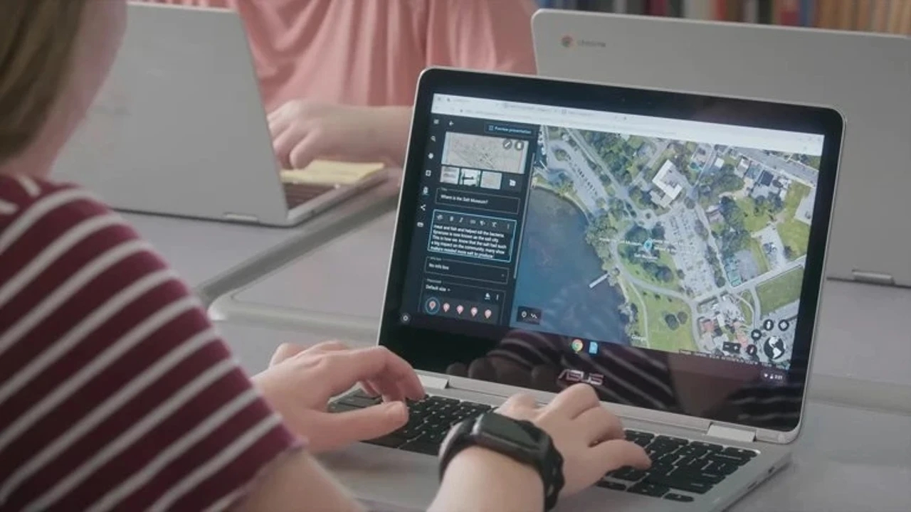
The windows of Internet browsers are now just going beyond being a single straight-to-one interface that is accessible to the information, articles and social media streams. Improved cloud ecosystems and server-sided data processing capacities, while users turn them into a global digital pilot from where they sat on, the limits of the internet are also retracted. This strategic step, which Google Earth jumps, melts pure entertainment culture in an excellent crucible, while melting the global projects and artificial intelligence-supported map services and geographic information systems Home The larger digital twin technologies that you can move to the size are accessible, smooth and open to the public clearly display the eyes. In this new generation digital ecosystem, where hardware limits are completely eliminated by strong and expensive computer obligations, there is only one site for users now exploring the world freely from the cockpit of a plane.
Writer